 A new seismological network has been established in the Sudetic region to record natural seismic microquakes.
The project was carried out as part of the Geodynamic Monitoring of Poland – stage IV project, funded by the National Fund for Environmental Protection and Water Management and conducted by the Geoscience Centre of the Polish Geological Institute – National Research Institute. The Centre for Modelling of Geological Processes of the Lower Silesian Branch of PGI-NRI is responsible for the Sudetic part.
The first stage of the network's construction covered the area of the Kłodzko region and its surroundings – a region which, as indicated by neotectonic, geodetic and palaeoseismological studies to date, shows clear current geodynamic activity. On the Czech side, seismic phenomena have been regularly monitored for almost 30 years. The new network will enable a more accurate analysis of seismic phenomena in Poland and strengthen cross-border scientific cooperation through integration with the Czech seismological networks CRSN and MONET.
The Sudetic Seismological Network has been officially registered with the FSDN in 2024 under the acronym S9 with the following DOI: https://dx.doi.org/10.7914/s0aq-xq29. The data recorded by the S9 network will be shared with global seismological data servers on an ongoing basis following international standards.
One of the key research goals of the Sudetic Seismological Network is to determine the statistical parameters of the region's seismicity. After several years of systematic recording, the collected data will enable the creation of a modern seismic hazards model for the Kłodzko region and its surroundings, and in the future for the entire Sudetic area.
Thanks to modern methods of microearthquake analysis, it will be possible to precisely identify seismogenic faults and their course deep into the Earth's crust. This is an important step in understanding the modern geodynamic processes taking place in the region. Adequate density of the seismological network will also enable analysis of the earthquake focus mechanism, providing valuable information on the state of stress in the rock mass.
An additional effect of the studies will be the development of a more accurate model of seismic wave velocities in the Earth's crust, which will allow better understanding of the deep geological structure of south-western Poland. The seismological results, enriched with geodetic, neotectonic and palaeoseismological data and numerical modelling, will be used to precisely determine safety parameters for large geotechnical investments in the Sudetic region.
The newly established Sudetic Seismological Network (S9) consists of 12 seismic stations distributed in and around the Kłodzko region. Their locations and codes are shown on the figure above, together with stations belonging to the PSG_Sejs_NET, the Polish Seismological Network (PLSN) and the Czech Regional Seismological Network (CRSN) and the MONET network.
Infomats have been installed at the underground sites in Kletno, Złoty Stok, Osówka and Szklary, which are open to tourists and display the recorded seismic signals in real time. The aim of this initiative is to popularise science and promote the Geodynamic Monitoring of Poland project to the public. Thanks to the infomats, visitors are able to:
- see real-time data from local seismic stations,
- learn more about seismic activity in the Sudetic region,
- understand the importance of monitoring geodynamic processes.
This is an excellent opportunity to raise public awareness of seismic hazards and the importance of geophysical research for the safety and development of the region.

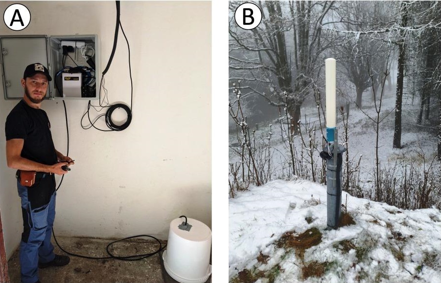
BUKO seismic station in Bukowina near Pstrążna. A) A room with a seismometer and a box with a recorder, a router and a buffer power supply. Photo M. Dąbrowski. B) View of the GNSS antenna and the antenna amplifying the GSM signal.. Photo: A. Haczek

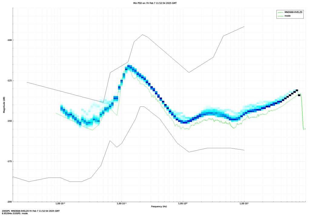
An example analysis of seismic noise from the seismic station of the S9 network. Power spectral density of noise recorded at the WIRY station during a 3-hour period on 07/02/2025 (HHZ component). The chart was made in the Discovery program

View of the infomat installed on the Underground Educational Route of the closed Nickel, Chyzoprase and Opal mine in Szklary. Photo: Sz. Kostka

The Sudetic Seismological Network was financed by the National Fund for Environmental Protection and Water Management.
Text: Marcin Dąbrowski, Bartłomiej Grochmal, Marcin Olkowicz, Kamila Karkowska


 PGI-NRI offer
 Mineral resources of Poland
  Oil and Gas in Poland


 Subscribe to RSS Feed